Some of the links in this article may be affiliate links. If you make a purchase through these links, we may earn a small commission at no extra cost to you. Thank you.
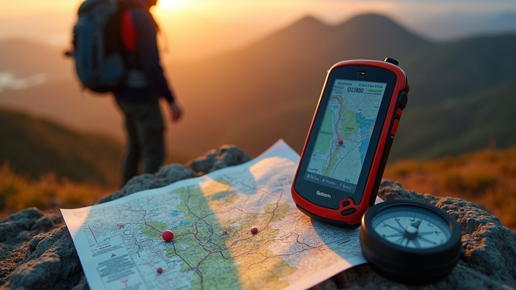
I’ve spent years tweaking my GPS navigation setup, and I’ll tell you what—mastering coordinates and waypoint management isn’t just nice to have, it’s essential if you’re serious about precision on the water. Whether you’re marking that honey hole or plotting a complex route, the difference between success and frustration often comes down to how well you understand these systems. Let me walk you through what I’ve learned the hard way.
Thank you for reading this post, don't forget to subscribe!
Understanding GPS Coordinate Systems

How do we make sense of our exact position on this massive planet of ours?
I’ve found that understanding GPS coordinate systems is essential for effective navigation.
When I’m using mapping tools, I rely on latitude and longitude—the fundamental framework that pinpoints our location.
Latitude and longitude serve as our planetary address system, providing exact coordinates for every point on Earth’s surface.
Latitude measures north-south position (from 0° at the equator to 90° at the poles), while longitude measures east-west (from 0° at the Prime Meridian to 180°).
I think of them as the planet’s built-in internal compass.
When setting up a waypoint or trying to record tracks, you’ll encounter coordinates in different formats.
Sometimes they’re decimal degrees (like 40.7128° N), or they might appear as degrees, minutes, seconds (40° 42′ 51.12″ N).
Both work with your digital compass, though I’ve personally found decimal degrees easier when sharing locations.
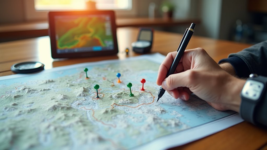
Essential Waypoint Creation Techniques
The art of creating waypoints is foundational to modern GPS navigation, and I’ve learned that mastering these techniques can transform your outdoor experiences.
When I need to create a waypoint using my Axiom, I simply long-press the chart display—this is how I save a spot with precise coordinates.
For my starting point on longer journeys, I’ll often manually enter exact latitude and longitude values.
You know, one thing that’s really useful is assigning waypoints to groups—all my fishing spots are saved on the Humminbird together.
Track Points can be converted to waypoints too!
When planning a route using multiple points, a new course is created that you can follow with Go To functionality.
I’ve found adding comments (up to 40 characters) makes identifying locations way easier later.
Organizing Waypoints for Efficient Navigation
I’ve found that organizing my waypoints into tagged groups is the key to avoiding that frustrating “where was that spot again?” moment when I’m out on the water.
You can make navigation so much easier by setting up a smart group-based management system – maybe fishing holes in one category and hiking trails in another.
When you sync everything to the cloud, you’ll never lose those perfect locations again, even if your GPS device decides to take an unexpected swim (which happened to me last summer, trust me).
Waypoint Tagging Systems
Organizing your waypoints effectively can mean the difference between a smooth journey and hours of frustrating scrolling through endless location data.
When I’m out on the water, I rely on grouping my waypoints by activity—like separating my favorite Spot-Lock positions from cache locations I might revisit later.
The Settings menu on your GPS isn’t just for adjustments; it’s where the real Advanced GPS Navigation Control happens.
From the Home screen, I can assign descriptive names instead of “Waypoint 001” and add short comments about water conditions.
I think the multi-editing feature is particularly valuable—you can give an entire group a new heading with one action.
Whether you’re using i-Track or integrating with a One-Boat Network, proper tagging transforms how efficiently you navigate.
Group-Based Waypoint Management
Why settle for a chaotic jumble of waypoints when you can transform your GPS into a well-organized navigation hub?
I’ve found that creating logical groups for your waypoints is a game-changer for serious navigators.
Instead of scrolling through countless unmarked locations, you can assign waypoints to specific categories—fishing spots in one group, hiking trails in another.
The real power comes with multi-editing capabilities.
When I need to update several waypoints, I can change their attributes simultaneously within a group.
Need to free up space after hitting that “Storage Full” message with your Spot-Lock locations?
Bulk deletion within groups makes this a breeze.
Don’t forget about renaming your waypoints from those generic numbered sequences.
Trust me, proper organization and management will revolutionize how efficiently you navigate.
Cloud Synchronization Techniques
Once you’ve mastered organizing your waypoints locally, the next level of navigation mastery comes through cloud synchronization.
I’ve found that connected fish finders, as part of the One-Boat Network, offer incredible flexibility when paired with cloud services.
Your compatible Humminbird fish finder needs to be connected to truly leverage the App in Motor Controls for seamless waypoint management.
- Exceed storage limits – store more than the standard 20 waypoints and i-Tracks by initiating that action through cloud backup
- Real-time updates – modify labels and coordinates across all your devices instantly
- Cross-platform access – retrieve waypoints from your phone, PC, or fish finder whenever needed
Advanced GPS uses cloud technology to guarantee you never lose critical information from connected devices.
In my experience, the ability to record tracks and access them anywhere has revolutionized how I navigate on water.
Advanced Route Planning With Waypoint Sequences
When mastering advanced GPS navigation, you’ll quickly discover that creating waypoint sequences is where the real power lies.
I’ve found that building an efficient course requires careful plotting – you’ll need to long press on your chart to add points that serve as your intermediate stops.
Before starting a new route, make sure to stop any existing navigation on your system’s control head.
Trust me, this prevents conflicts with your compass heading data.
In my experience, the internal compass to provide heading information works best when you’ve taken time to organize your waypoints into logical groups.
To follow the Track effectively, I recommend customizing each waypoint with relevant comments (up to 40 characters).
Advanced GPS Navigation Compatibility varies between devices, but most navigation controls allow precise finger-based plotting when you zoom in properly.
Integrating GPS Navigation With Marine Electronics
The real magic happens when you connect your GPS navigation system with other marine electronics onboard.
I’ve found that integrating my Humminbird fish finder with Motor Sync transforms how I navigate on water.
When connected to a compatible trolling motor, you’ll access powerful features:
- Spot-Lock holds your position with pinpoint accuracy while you’re fishing
- Course AutoPilot and Locked Heading AutoPilot let you set and maintain direction without constant adjustments
- One-Boat Network Mobile App turns your phone into a digital remote for all navigation functions
You might need an Ethernet adapter cable for compatibility between devices, but trust me, it’s worth it.
The Virtual Remote feature is incredible—I can control trolling motor speed and engage Spot-Lock directly from my finder screen.
It’s like having a co-captain onboard!
Maximizing Trolling Motor Autopilot Features
I’ve found that mastering your trolling motor’s autopilot features can transform your fishing experience, especially when you understand how Spot-Lock technology keeps you positioned over productive areas.
You’ll want to explore route recording techniques that let you save and replay successful trolling patterns – something I wish I’d learned years ago.
Maximizing battery life through strategic use of these features means you’ll spend more time fishing and less time worrying about heading back to shore, which is really what we’re all after on the water.
Understanding Spot-Lock Technology
Have you ever noticed how frustrating it can be when wind and currents keep pushing your boat away from that perfect fishing spot?
That’s where Spot-Lock technology comes in.
This Advanced AutoPilot keeps the boat precisely positioned by using GPS to correct for cross winds and currents.
The Locked Heading AutoPilot locks onto not just a compass heading but also GPS coordinates, fighting external forces to keep you on target.
I’ve found Spot-Lock particularly valuable for these reasons:
- Stores up to 20 favorite fishing locations for instant recall
- Seamlessly integrates with the internal compass to provide stability within feet of your target
- Allows adjustment of circle radius through the remote or mobile app
You can easily engage Spot-Lock via remote or smartphone, making those perfect fishing spots truly “lockable.”
Route Recording Techniques
Mastering route recording techniques can transform your GPS navigation experience from good to exceptional. I’ve found that BackTrack’s ability to record iTracks for a distance up to 2 miles gives me incredible control on the water. You can set an offset during the track recording to keep your boat exactly where you need it.
| Feature | Function | Benefit | AutoPilot Mode | Exit Method |
|---|---|---|---|---|
| iTracks | Route recording | Precise retracing | Locked Course | Manual override |
| BackTrack | Stores 20 routes | Organizational flexibility | Heading AutoPilot locks direction | Button press |
| Follow Contour | Tracks depth | Consistent fishing zones | Course AutoPilot will keep path | Remote cancel |
| Go To | Automatic navigation | Hands-free return | Use Locked Heading AutoPilot | Function can be exited anytime |
| One-Boat Network | Digital management | Routes is not part of memory limit | Keeps the boat traveling straight | App disconnect |
Battery Life Optimization
Why spend extra on batteries when you can stretch your existing ones with smart autopilot management?
I’ve found that understanding the behavior of the system makes all the difference.
When facing strong current, it’s best to use Locked Course mode, which keeps the motor making small, efficient corrections instead of constantly fighting the water.
- Engage Cruise Control so your speed over ground becomes consistent, even when conditions change—it’s powerful enough to overcome resistance without wasting energy
- Toggle Spot-Lock and Advanced features only when necessary, then switch back to Heading AutoPilot and let the GPS do the work with minimal battery drain
- Monitor your power usage through the One-Boat Network App, ensuring you’ve got enough power to control your journey without overdoing it
Tactical Applications of Waypoint Management
When traversing through hostile territory or coordinating complex team maneuvers, how you manage your waypoints can literally mean the difference between mission success and failure. I’ve found that in strong winds or current, your Course AutoPilot becomes the Target that keeps the motor pointed where you need to go. You’ll need to manually steer your boat on the course sometimes, but a new compass display helps you control the boat smoothly when conditions change.
| Tactical Application | Primary Benefit | Equipment Needed | Communication Method |
|---|---|---|---|
| Military Operations | Precise targeting | GPS receiver | Lat/Long coordinates |
| Emergency Response | Safe extraction | Marine GPS | Digital markers |
| Reconnaissance | Route planning | Trolling motors | Waypoint sharing |
| Team Coordination | Situational awareness | Spot-Lock systems | Real-time positioning |
Troubleshooting Common GPS Navigation Challenges
How effectively you troubleshoot GPS navigation issues can make all the difference between smooth sailing and being completely lost on the water.
I’ve found that when you’re facing challenges with your compatible products including Humminbird systems, there’s usually a straightforward fix.
When Course AutoPilot is turned on but your boat seems to drift in cross winds, remember that steering correction is made based on current and other external factors.
Take command of speed issues when your cruise control can’t be activated by being able to adjust using the remote.
Here are my top troubleshooting tips:
- Clear “Storage Full” errors by deleting unnecessary waypoints
- Verify proper connectivity with your Humminbird using the correct Ethernet adapter
- Verify GPS accuracy by confirming signals from at least four satellites
Frequently Asked Questions
What Is a Waypoint in GPS Navigation?
I use waypoints as specific locations marked by coordinates in my GPS. They’ve evolved through waypoint history to help me navigate terrain features and avoid navigation errors when geocaching or using mapping software.
What Is Minn Kota Advanced GPS Navigation?
Minn Kota’s advanced GPS navigation is my go-to for precision fishing. I love its Spot Lock accuracy, Auto Pilot features, depth integration, and remote control options. It optimizes battery efficiency while allowing speed adjustment for various applications.
How to Increase Navigation Skills?
I’d recommend daily map reading practice, compass training, and route planning exercises. Conduct skill drills focusing on terrain analysis, orientation, and error avoidance. Don’t forget safety protocols and speed control practice.
How to Use Minn Kota Terrova Advanced GPS?
I’d laugh at manual-readers, but Terrova setup is simple! Activate Autopilot with one button, engage Spot lock features when fishing, manage speed control effortlessly, and don’t forget regular software updates for ideal GPS calibration.