Some of the links in this article may be affiliate links. If you make a purchase through these links, we may earn a small commission at no extra cost to you. Thank you.
I’ve tested several handheld GPS options for geocaching and I’ll share what makes the top picks stand out. From durability to multi-GNSS support and long battery life, these devices cover different needs and budgets. I’ll weigh how each model handles maps, paperless caching, and rugged use. If you’re aiming for reliable signal reception in tough terrain, this list is a solid starting point, and I’ll point out practical trade-offs so you can decide what matters most.
Thank you for reading this post, don't forget to subscribe!
Garmin eTrex SE GPS Handheld Navigator (Renewed)

- The 2.2” high-resolution display is easy to read, even in bright sunlight
- Get long battery life of up to 168 hours in standard mode and up to 1,800 hours in expedition mode with 2 field-replaceable AA batteries (not included)
- Pair with the Garmin Explore app on your compatible smartphone for wireless software updates, trip planning, Active Weather, smart notifications and additional mapping
- Get automatic cache updates from Geocaching Live, including descriptions, logs and hints when paired to the Garmin Explore app on your compatible smartphone
- Multi-GNSS support gives access to multiple global navigation satellite systems (GPS, GLONASS, Galileo, BeiDou and QZSS) to track in more challenging environments than GPS alone
If you want a rugged, long-lasting GPS that won’t quit in the field, the Garmin eTrex SE (Renewed) is the pick for geocachers who crave reliability and multi-GNSS support. I’m drawn to its 2.2” high-resolution display, readable in bright sun, along with IPX7 water resistance that stands up to rain and splashes. It runs on two field-replaceable AA batteries, delivering up to 168 hours in standard mode or 1,800 hours in expedition mode. I pair it with the Garmin Explore app for updates, planning, and Geocaching Live cache data, while multi-GNSS ensures solid satellite coverage.
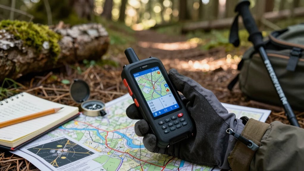
A8 Handheld GPS for Hiking with Base Map

- Excellent Satellite Support: Access Multi-GNSS navigation satellite systems (GPS+GALILEO+BEIDOU+QZSS) for improved position accuracy,location precision withih 5 ft, allows for tracking in more challenging environments than GPS alone
- Waypoint navigation, set routes , track navigation, uses GPS technology to capture your trip or waypoint so you can guide back to your starting position when you lost your direction,the most reliable partner for your outdoor adventure
- Large Screen: A8 handheld navigator with 3.2” sunlight-readable color display for easy viewing.16GB of internal memory to save and track 20,000 waypoints, 1000 routes and 1000 tracks
- Extended Battery Life: 4000mAh battery lasts up to 24 hours use.Simply charge it with USB and you're ready to go,it is an ideal rugged waterproof GPS Navigator for wide range of outdoor camping hiking agriculture
- USA Basemap: This A8 Handheld GPS comes with a 12 level basic traffic map for the United States. If you want a map with a larger zoom ratio, you can refer to the download map videos and down load by yourself, or contact us for help downloading the map
The A8 Handheld GPS for Hiking with Base Map is ideal for hikers who prize a rugged, all-in-one device, since its multi-GNSS support (GPS, Galileo, Beidou, and QZSS) delivers reliable position accuracy within about 5 feet and enhanced tracking in challenging environments. I rely on the USA Basemap and the 3.2-inch sunlight-readable color screen to navigate with confidence, storing up to 20,000 waypoints, 1,000 routes, and 1,000 tracks. It runs up to 24 hours on a 4000mAh battery, with rugged, waterproof construction. Remember outdoor-only satellite signals; larger maps are downloadable, and HDOP below 1 boosts accuracy.
Rugged Handheld GPS Navigator with Topo Map and GNSS
No products found.
This rugged handheld GPS navigator shines for geocachers who need dependable accuracy and endurance in challenging outdoors, thanks to multi-GNSS support (GPS, Galileo, Beidou, QZSS) and a precise 6-foot location capability. I pair this compact device with its anti-slip, IP66-rated shell and a bright 3.2″ sunlight-readable display, plus physical buttons that feel reliable in any conditions. It delivers multi-GNSS accuracy, a 3-axis compass, and a barometric altimeter to keep bearings true, even when stationary. With up to 36 hours of use on a single charge and USB-C, it preloads USA Topo maps and stores data in 32 GB.
Garmin eTrex Solar GPS Handheld Navigator

- The 2.2” high-contrast display is easy to read, even in bright sunlight
- Get unlimited battery life when used in sunny conditions (75,000 lux) or up to 200 hours with no solar charging
- Multi-band GPS gives you access to multiple frequencies sent by navigation satellites to provide superior positional accuracy
- Pair with the Garmin Explore app on your compatible smartphone for wireless software updates, trip planning, weather, smart notifications and additional mapping
- Get cache updates from Geocaching Live, including descriptions, logs and hints when paired to the Garmin Explore app on your compatible smartphone
For geocachers who crave reliability in tough conditions, the Garmin eTrex Solar GPS Handheld Navigator stands out with its unlimited solar-assisted operation and rugged, IPX7-rated build. I’ve tested it in rain and dust, and the 2.2” high-contrast display remains readable. Its weather-ready design pairs with multi-band GPS for precise positioning, and the digital compass stays accurate even when I’m still. With Garmin Explore, updates, trip planning, weather, and smart notifications sync wirelessly, plus Geocaching Live logs and hints feed directly to my device. In solar-friendly sunny conditions, battery life feels endless; otherwise, it still lasts long, no flea-market fragility here.
A6 Handheld GPS for Hiking and Camping

- HIGH ACCURACY:Access 4 global navigation satellite systems (GPS+GLONASS+BEIDOU+QZSS) for improved position accuracy, especially in challenging terrain or areas with weak signals, position accuracy<5ft
- SCREEN: 2.4 inch sunlight-readable color display for easy viewing, can see the navigation interface clearly even at night,also equipped with button-operated and non-slip design
- 4 WAYPOINT FUNCTION: Save current GPS coordinates, enter known coordinates, and navigate to the coordinates, delete coordinates,can save 1000 waypoints
- TRACK NAVIGATION: Record your tracks before hiking,it can guide back to your starting position when you lost your direction,and store waypoints along a track,the most reliable partner for your outdoor adventure
- MULTI CHARGING METHODS: Powered by internal Li-ion rechargeable battery,3500mAh battery lasts up to 20 hours use in navigation mode,support power bank, car charing, USB charging and so on.Rugged and waterproof(rated to IP65)
A6 Handheld GPS is ideal for hikers and campers who need reliable, long-lasting navigation with multiple satellite systems. I trust its 4 GNSS mix—GPS, GLONASS, BEIDOU, QZSS—delivering <5 ft accuracy. The 2.4" color display stays legible in sun and switches to night view, and the button control plus non-slip body feel sturdy in action. You can save 1000 waypoints, navigate to known coordinates, and route along a track, storing waypoints along the way. With a 3500mAh battery, it runs up to 20 hours and supports USB, car charging, or a power bank. Rugged, IP65, maps not included.
NAVA F30 Handheld GPS Navigation for Outdoors
No products found.
If you’re geocaching outdoors and need a rugged companion, the NAVA F30 stands out with its 4 GB internal memory and optional 32 GB TF card, plus a long-lasting power offer of up to 20 hours on two AA batteries. I appreciate its GLONASS receiver for better satellite access and a worldwide basemap preloaded, plus paperless geocaching and multiple map formats (GPX, SHP, KML, DXF). The 2.2″ transflective display stays readable in sun, and it supports GPS, GLONASS, and BEIDOU. Four languages help, and maps are downloadable for free, with PC sync for managing waypoints, routes, and tracks.
Garmin GPSMAP 65 Handheld with Multi-Band Tech
No products found.
The Garmin GPSMAP 65 Handheld with Multi-Band Tech stands out for geocachers who need reliable accuracy in challenging environments thanks to its expanded global satellite support and multi-band technology. I test it on steep trails, urban canyons, and dense forests, where signal quirks happen. Its 2.6” sunlight-readable color display stays readable, while routable TopoActive maps and a federal public land map (U.S. only) guide me efficiently. I use Garmin Explore for sync, and I manage tracks, routes, and waypoints, reviewing field statistics later. It’s compatible with the app, though you’ll need a smartphone for access.
Factors to Consider When Choosing Handheld Gps for Geocaching
When I pick a handheld GPS for geocaching, I start by weighing Battery Life Endurance, since long hunts demand plenty of power without frequent recharges. I also look for Multi-GNSS Support, clear Screen Readability, solid Map Availability, and solid Durability with a good IP Rating to handle outdoor elements. In short, the right device balances practical endurance, broad satellite compatibility, readable display, reliable mapping, and rugged construction.
Battery Life Endurance
Battery life is one of the most practical trade-offs when picking a handheld GPS for geocaching. In practice, endurance varies from about 24 hours in standard use to as high as 1,800 hours in expedition modes, depending on power settings and activity level. Solar-assisted models can deliver effectively unlimited endurance under strong, continuous sunlight, though clouds and usage limit that benefit. Interchangeable batteries, like AA options, extend field life, so I carry spares for long trips. Power-saving features—lower screen brightness, shorter backlight, and minimal GPS activity—hugely affect overall endurance. Charging options (USB, car, or solar) and the number of GNSS signals tracked also influence depletion rates. Choosing a device with flexible power options helps me geocache longer between stops.
Multi-GNSS Support
Multi-GNSS support lets me pull in GPS, GLONASS, Galileo, Beidou, and QZSS signals at once, which means more satellites in view and better accuracy. I look for devices that maintain lock in tricky spots, like urban canyons or dense forests, where a single constellation can struggle. Multi-GNSS helps here by reducing dropout and sustaining reliable positioning when signals are partially blocked. Some models advertise multi-band capabilities alongside multi-GNSS, offering even tighter fixes in difficult terrain. For geocaching, this translates to sharper waypoint accuracy and steadier route tracking, especially under variable sky visibility. In practice, the benefit shows up as lower HDOP and more consistent readings during outdoor searches, making navigation calmer and more confident.
Screen Readability
Screen readability is essential for geocaching, and I look for displays that stay clear from sunrise to sunset. I favor 2.2–3.2 inch screens because bigger panels make it easier to letraing and spot waypoints while scouting terrain. Daylight-visible displays are a must, cutting glare in bright conditions so symbols stay legible. High-contrast, high-resolution screens improve text and icon clarity when I’m traversing contours or reading terrain details. Transflective or glare-resistant panels help me switch between shade, sun, and reflective surfaces without squinting. Some models pair rugged, high-contrast panels with physical buttons, which keeps control usable even in wet weather or when I’m wearing gloves. In practice, readability directly impacts my efficiency and success.
Map Availability
Map availability matters as much as visibility when geocaching, since having the right maps on hand keeps you from chasing unnecessary routes. I look for units with preloaded maps like USA Topo or basemaps so you have immediate coverage without downloads. Expandable map storage, such as 16 GB or 32 GB, matters too, letting me store extra topo or raster maps for different regions. I also consider models that support downloadable maps or larger zoom sets, even if they require separate downloads. Connectivity or companion apps can affect map updates, so I want devices that update maps via paired software or online services. Most importantly, I verify the device supports topo, basemap, or street maps and lets me view cached locations alongside maps.
Durability & IP Rating
Durability is non-negotiable when geocaching, because you’ll push devices to the edge of weather, mud, and rough terrain. I look for an IP-rated enclosure (think IPX7 or IP65/66) to stay reliable in rain, splashes, or immersion during hikes and hunts. A rugged, anti-slip or textured shell matters, reducing drop risks on rocks or mud and helping grip with gloves. Weather-ready designs protect internal components from dust, rain, and temperature swings you’ll encounter outdoors. Physical, glove-friendly buttons and reinforced bezels keep operation smooth when conditions are harsh. Sealed ports and covered connectors contribute to long-term durability by blocking moisture ingress during extended outdoor use, so your device stays trustworthy, even after tough adventures.
Data Management Power
Data management power matters because a handheld GPS with ample storage and flexible data handling keeps geocaching efficient and enjoyable. I look for larger internal storage to save thousands of waypoints, routes, and tracks, with capacities around 16GB or more and up to 20,000 waypoints, 1,000 routes, and 1,000 tracks. I value support for multiple data formats—GPX, SHP, MIF, CSV, KML, DXF, TXF—so importing, exporting, and sharing data is seamless. USB charging or USB-C compatibility and PC synchronization help me back up coordinates and logs without a hitch. Preloaded maps plus the option to download more map data provide essential context for planning. Paperless caching and built-in data management keep cache descriptions, logs, hints, and coordinates organized and accessible.
Connectivity & Apps
Ever wonder how connectivity and apps can simplify geocaching on a handheld GPS? I’ve found that pairing with a dedicated app, like Garmin Explore, streamlines wireless software updates, trip planning, and extra mapping features. Geocaching-specific perks kick in when the device stays synced—the app delivers automatic Live cache updates, including descriptions, logs, and hints. Access to Active Weather and smart notifications helps me plan sessions around conditions, not just locations. Compatibility usually needs an initial setup and ongoing synchronization to keep maps and caches current, but the payoff is smoother workflows and up-to-date data. An app ecosystem often enhances map downloads, firmware updates, and route sharing, making planning and executing hunts more efficient and enjoyable.
Waypoint Accuracy
To get reliable waypoint accuracy for geocaching, I look for multi-constellation GNSS support (GPS, GLONASS, BEIDOU, GALILEO, QZSS) because it typically improves precision, especially where skies aren’t ideal. Using multiple GNSS constellations generally boosts accuracy versus GPS alone, particularly in challenging environments. In good sky visibility, typical handheld devices report horizontal position accuracy around 5–6 feet (about 1.5–2 meters), with better results in open areas. HDOP values below 1 indicate higher-precision positioning and should be used when accuracy is critical. In obstructed areas like dense trees or urban canyons, accuracy degrades despite multi-constellation support due to satellite geometry constraints. Navigation aids like a digital compass or barometric altimeter don’t directly improve horizontal accuracy but aid bearing and situational awareness.
Conclusion
I’ve seen geocachers succeed with any of these great rigs, as long as you match features to your hunts. For example, a runner-up user once relied on the Garmin eTrex SE’s rugged simplicity to locate a challenging cache after a storm, proving reliability beats bells and whistles. If you want longer trips and offline maps, the GPSMAP 65 or Rugged Topo Navigator are solid bets. Pick what fits your adventures, and you’ll stay cache-hunting with confidence.